More fun with old aerial photos.
Kent, Washington, July, 18, 1940.
People have asked what we would do with five yards of compost. Unfortunately, few photos exist to explain the mysterious appearance and disappearance of said giant heap.
This gun was found just a few feet from this sign on the gate protecting the gravel road leading to this facility.
A bird has made a nest in a hanging fern on our front porch. We hope her willingness to share the porch with us will continue once the eggs hatch.
We recently took two trips from Bowling Green, KY to Murray, KY. The directions are easy: take KY 68/80 westward. In Bowling Green, KY 68/80 is called Russellville Road. Follow it to the edge of town. Go straight through Rockfield. At Russellville you can take the bypass or not. It's about the same either way. The first time we went it was raining but the second trip was sunny enough to make a stop in Fairview worthwhile to see the Jefferson Davis Monument. There is a small graveyard at the base of the monument. The effect of a 351 foot tall concrete spire rising up from the center of this tiny farming community is stunning and surreal. We passed through downtown Hopkinsville. Then you cross a narrow bridge to a huge National Recreation Area called Land Between the Lakes, an inland peninsula formed when the Cumberland and Tennessee Rivers were impounded to create Kentucky Lake and Lake Barkley. Turn left onto KY 94 and it's just a few more miles until you cross the tracks and arrive in downtown Murray.
Every once in a while you bump into something especially interesting in old aerial photos.
Green River, Washington, July 18, 1940.
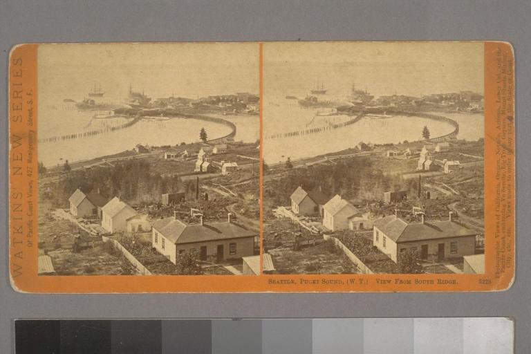
Old Seattle, courtesy of the Berkeley Digital Library SunSITE. (From our San Francisco friend Elise.)